

Hiking Route GPX file Download and Map - Route 1
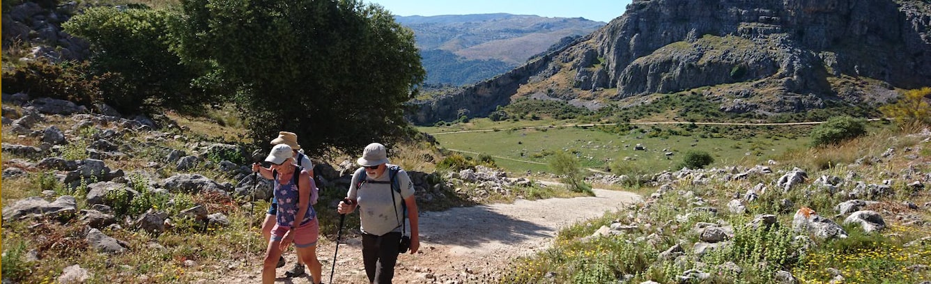
This moderate circular walk begins at Ronda's main Puente Nuevo bridge and then heads down into the valley below for spectacular views back up to the bridge. It continues downhill on mainly unsurfaced tracks and explores the Indiana valley before requiring a steady climb back up to Ronda.
From the Puente Nuevo, the route takes a small road through the old town to reach some cobbled steps which lead down the side of the gorge. There are a couple of spots along the way to catch the perfect photo of the bridge before a short climb out of the valley into a cooling pine forest. Unsurfaced tracks through the forest, over the river and under the railway bring us to the lowest point of the route, before we cross the railway again and then head into an extensive area of pine forest, filled with small pathways and trails for the climb back up into Ronda.
Hiking Route GPX file Download and Map - Route 2
This challenging circular walk begins in the far south of Ronda, in the area known as the Barrio San Francisco. It is fundamentally one long steady climb to reach a high point in the limestone mountains to the south-west of the town, before descending down via the striking rock formations of the Tajo del Abanico (fan gorge) back to the town. The walk is almost all on unsurfaced tracks, with some stony sections, so walkers need good walking boots/shoes and to be happy walking on extended sections of uneven ground, along with moderate to good fitness to cope with the long hill climb.
From the barrio, the route exits town via small residential streets to soon enter olive groves and pass by an old water source at the Pilar de Cartajima. The main climb then stretches for nearly 5km, steadily gaining height into the remote mountains. Some of the landscape is rocky and bare, whilst other sections are heavily wooded, eventually leading to a farm, which requires an unusual little detour to get through their gates to keep on the official cañada route and stay off their private access road. The route then descends sharply into the gorge area, where thousands of years of wind and high winter water levels in the river have eroded a deep channel through the limestone, creating at one point the spectacular fan shape, opposite a large cave. The route then continues through extensive of holm oak forest before a final climb back into the barrio.